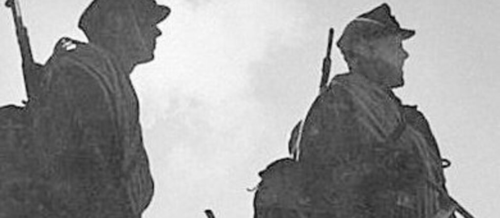
The challenge at five thousand: how the Caucasus changed mountain warfare
Sasha Schoenberg2026-08-25T09:03:51+00:00In the collective imagination, mountain warfare is immediately associated, at least in European historiography, with the one fought on the Italian Front during the First World War.
On closer inspection, however, there are several examples that could challenge this primacy. From the various military events that have marked foreign interventions in Afghanistan since the nineteenth century, to the age-old dispute between India and Pakistan over the mountainous region of Kashmir.
There is, however, another front that, even today, stands out as an area of ongoing conflict: the Caucasus.
This region has a variety of factors that have made it, for centuries, one of the main sources of tension with neighbouring Russia. Ethnic rivalries, autonomist impulses, and religious opposition make it a central theatre for the geopolitics of the Eurasian region – all intensified by the presence of significant energy resources (King, 2008). This region has, in fact, been the scene of numerous historical events that help clarify its strategic value even for today’s balances.
To understand the value of the Caucasus for NATO’s strategic position, it is also necessary to start from an essential consideration: one of its members, Türkiye, is directly involved in the regional balance.
Separating it from the Russian Federation, alongside countries such as Georgia and Azerbaijan, are the majestic peaks of the Caucasus range, among which Mount Elbrus (5,642 m) stands out.
For this reason, it is worth retracing what happened among those snow-covered peaks and grasping the meaning of those events, trying to learn lessons from them in order to think about the patterns NATO faces today in confronting its challenges.
Mountains Between Empires
Long before the Caucasus acquired its present geopolitical significance, its geography had already made it a natural frontier between competing political worlds. Between the Black Sea and the Caspian, the Caucasus forms not simply a mountain chain but a complex system of valleys, plateaus, passes and isolated communities. Geography fragmented political space and simultaneously made control of the principal routes through the mountains strategically valuable (King, 2008).
During the nineteenth century, this became particularly evident as the Russian Empire expanded southwards (King, 2008).
Russian expansion into the Caucasus was neither a single campaign nor a simple movement across an empty geographical space. The incorporation of Georgian territories into the Russian imperial system, wars against Persia and the Ottoman Empire, and the prolonged resistance of peoples of the North Caucasus gradually transformed the region into one of the most militarised imperial frontiers of the century (King, 2008; Allen & Muratoff, 1953). The Caucasian War, conventionally dated from 1817 to 1864, alone demonstrates the difficulties involved in converting conventional military superiority into lasting control over mountainous territory.
The Russian experience exposed a fundamental characteristic of mountain warfare: occupation and control are not synonymous.
An army could occupy roads, fortresses and settlements while remaining unable to exercise continuous authority over the valleys and mountain communities surrounding them. The topography provided weaker forces with possibilities for concealment, movement and resistance while imposing considerable demands upon an army attempting to maintain communications and supply (King, 2008).
The famous Georgian Military Road, crossing the central Caucasus, illustrates the opposite side of the same problem. Mountains obstruct movement, but precisely for this reason the routes that successfully cross them acquire disproportionate strategic importance. A pass, road or valley may become more significant than vast expanses of surrounding territory (King, 2008).
The Caucasus therefore became a frontier in two different senses: a barrier separating empires and a network of corridors through which those empires attempted to project power.
This dynamic was particularly visible in the long rivalry between Russia and the Ottoman Empire. By the late nineteenth century, successive Russo-Ottoman conflicts had progressively shifted the regional balance. The Caucasian theatre of the Russo-Turkish War of 1877–1878 again demonstrated the military significance of eastern Anatolia and the southern Caucasus. The eventual Russian acquisition of Kars, Ardahan and Batum moved the imperial frontier and created the geographical conditions under which the two empires would confront each other again in 1914 (Allen & Muratoff, 1953).
Thus, when the Ottoman Empire entered the First World War, the Caucasus was already the product of a century of imperial competition.
The mountains remembered earlier wars even if the armies preparing to fight the next one did not always appear to have learned their lessons.
Sarikamish: When Operational Ambition Met Winter
The Ottoman entry into the First World War opened a new chapter in this confrontation.
For Ottoman leaders, the Caucasus offered both danger and opportunity. Russian territory lay beyond the eastern frontier, while the recovery of lands lost during earlier conflicts remained an attractive political and military objective. The possibility of encouraging Muslim populations under Russian rule added another dimension to Ottoman strategic calculations (Allen & Muratoff, 1953; Erickson, 2001).
It was in this environment that Enver Pasha, Ottoman Minister of War, developed the offensive that culminated in the Battle of Sarikamish, fought between December 1914 and January 1915 (Allen & Muratoff, 1953; Erickson, 2001).
The plan was ambitious. The Ottoman Third Army would manoeuvre through difficult terrain in winter, envelop Russian forces around Sarikamish and achieve a decisive victory. On a map, the concept possessed an operational logic. On the ground, however, the distances, roads, weather and mountains transformed that logic (Allen & Muratoff, 1953; Erickson, 2001).
Sarikamish consequently became one of the most dramatic examples of the price an army can pay when its operational design exceeds its capacity to survive the environment in which it must be executed.
The Ottoman troops encountered deep snow, extreme cold, inadequate roads and enormous difficulties in maintaining supply and communications. Units became separated. March timetables became increasingly unrealistic. Soldiers already exhausted by movement and shortages faced temperatures for which many were inadequately equipped (Allen & Muratoff, 1953; Erickson, 2001).
The Russian Army remained the military opponent, but the environment became an additional and increasingly powerful adversary.
The Ottoman Third Army suffered catastrophic losses during the campaign. Although historical estimates vary considerably and not all casualties can be attributed directly to exposure, cold, exhaustion and disease were central elements of the disaster (Allen & Muratoff, 1953; Erickson, 2001).
Sarikamish therefore offers a lesson extending beyond the particular circumstances of 1914: terrain does not merely influence an operation; under extreme conditions, terrain can determine whether the operational concept remains possible at all.
A commander can order a unit to cover a certain distance. A map can demonstrate that the distance exists. Neither fact establishes that soldiers can actually cross it, arrive combat-effective, receive supplies and then fight.
This distinction becomes increasingly important with altitude and winter conditions.
Mountain warfare imposes a physical reality upon operational planning. Cold affects weapons, transport and communications, but above all it affects the human body. Snow changes distances. A kilometre measured horizontally on a map tells little about the effort required to negotiate elevation, ice and narrow paths. Casualty evacuation becomes slower. Supply consumption changes. The margin between delay and disaster becomes narrower.
Sarikamish demonstrated all these problems with exceptional brutality.
The Human Geography of the Front
Yet the Caucasus Front also demonstrates why mountain warfare cannot be understood through physical geography alone.
The region was inhabited by communities divided by language, religion, political allegiance and historical experience. Among them were large Armenian populations living on both sides of the Russo-Ottoman frontier (Suny, 2015).
During the war, Armenian volunteers fought alongside Russian forces, while Ottoman authorities increasingly viewed sections of their own Armenian population through the lens of military security and possible collaboration with Russia. These suspicions developed in the context of invasion, rebellion, intercommunal violence and the wider collapse of trust characteristic of the eastern front (Suny, 2015).
Following the Ottoman defeat at Sarikamish, the relationship between military insecurity and the treatment of Ottoman Armenians became still more consequential. In 1915, Ottoman authorities implemented mass deportations of Armenian civilians from eastern Anatolia and elsewhere. These deportations, accompanied by widespread killing, starvation, disease and mass death, form one of the most extensively studied and politically sensitive episodes of the First World War (Suny, 2015).
For the purposes of mountain warfare history, the significance of this tragic episode is not served by reducing it to contemporary political controversy. Rather, it demonstrates a broader military reality: the human terrain of a mountain region may be as operationally important as its physical terrain.
Mountain populations possess local knowledge. They know paths, valleys, seasonal conditions and routes that may be absent from military maps. Their political allegiance — or merely an army’s perception of that allegiance — can therefore acquire enormous strategic significance.
The Caucasus in 1914–1915 consequently illustrates two interconnected dimensions of mountain warfare. The first is environmental: climate, altitude, distance and logistics. The second is human: identity, loyalty, language, religion and local knowledge.
Ignoring either can transform military difficulty into strategic catastrophe.
Operation Edelweiss: Oil Beyond the Mountains
Less than three decades later, another army approached the Caucasus with very different political objectives but confronted remarkably familiar geographical problems.
By 1942, the strategic context had completely changed.
The Russian Empire and Ottoman Empire had disappeared. The Soviet Union now controlled the northern and much of the southern Caucasus, while Nazi Germany was engaged in a war whose scale dwarfed the imperial campaigns of the previous century. Yet the Caucasus remained strategically indispensable.
This time, the central issue was energy.
Modern mechanised warfare consumed enormous quantities of petroleum. The Soviet oil-producing regions of the Caucasus — above all Baku, but also Grozny and Maikop — therefore represented an objective of extraordinary importance to German strategy (Glantz & House, 2009; Boog et al., 2001).
In the summer of 1942, following the initial successes of the German offensive in southern Russia, Army Group A advanced towards the Caucasus. The campaign commonly associated with Operation Edelweiss sought to penetrate the region and seize its oil resources (Glantz & House, 2009; Boog et al., 2001).
The German advance was initially impressive. Maikop fell, German forces pushed deep into the northern Caucasus, and specialised mountain formations moved towards the high passes. But the geography increasingly imposed its own conditions upon the campaign (Boog et al., 2001).
Once again, the difference between advancing towards the Caucasus and mastering the Caucasus became apparent.
Armoured and motorised formations depended upon fuel, roads, maintenance and continuous logistical support. As German forces moved farther from their logistical bases, the very objective they sought — oil — became part of the logistical paradox confronting them. Capturing oilfields on a map was not sufficient. Facilities had to be taken intact or repaired; fuel had to be refined and transported; routes had to remain open. Meanwhile, the mountains channelled movement into predictable corridors (Glantz & House, 2009; Boog et al., 2001).
This gave enormous importance to the passes across the main Caucasus range. German Gebirgsjäger, specifically trained for mountain operations, possessed capabilities conventional formations lacked. Their equipment, physical preparation and tactical experience enabled them to operate in terrain where other formations would have encountered far greater difficulties (Boog et al., 2001).
And it was during this campaign that one of the most extraordinary symbolic episodes in the history of mountain warfare occurred.
The Flag on Elbrus
On 21 August 1942, soldiers of the German 1st Mountain Division reached the summit area of Mount Elbrus, the highest mountain in the Caucasus and, at 5,642 metres, the highest summit in Europe (Boog et al., 2001).
They raised German flags on the mountain. The photographs became famous.
From the perspective of mountaineering and military endurance, the achievement was remarkable. Soldiers had reached an altitude at which oxygen scarcity, cold and rapidly changing weather create significant physical challenges even in circumstances entirely removed from combat.
From the perspective of strategy, however, Elbrus exposed one of the central paradoxes of mountain warfare. The summit had been reached. The strategic objective had not.
The German flag on Elbrus did not open the road to Baku. It did not destroy the Soviet Caucasus Front. It did not solve Germany’s fuel problems. It did not secure the mountain passes required for further operations (Boog et al., 2001).
Indeed, even German leadership recognised the disproportion between the symbolic achievement and the strategic situation. The image of soldiers planting a flag on Europe’s highest summit possessed enormous propaganda potential, but the campaign was being decided elsewhere — by logistics, resistance, operational overstretch and developments across the wider southern sector of the Eastern Front (Boog et al., 2001; Glantz & House, 2009).
This distinction is perhaps one of the most useful lessons the Caucasus can offer military professionals today:
tactical possession of dominant terrain is valuable only insofar as it produces operational effect.
Mountains naturally attract attention towards summits. The highest point dominates the landscape and possesses an intuitive military symbolism. Yet the strategically decisive terrain may instead be a road, bridge, tunnel, valley, pass or logistical node located thousands of metres below.
The question therefore should not simply be: Can this terrain be occupied?
It should be: What does occupying it allow the force to do?
In 1942, Elbrus provided a spectacular answer to the first question and an uncomfortable answer to the second.
The Failure of Edelweiss
The wider German campaign ultimately failed.
German troops never reached Baku. Grozny remained beyond their grasp. Soviet resistance continued, while the enormous extension of German operations across southern Russia created logistical and operational problems that the Wehrmacht could not overcome (Boog et al., 2001; Glantz & House, 2009).
The Soviet victory at Stalingrad fundamentally altered the strategic situation and made the German position in the Caucasus increasingly dangerous. Army Group A was eventually forced to withdraw to avoid being cut off (Boog et al., 2001).
The contrast with August 1942 was striking. German mountain troops had stood on the highest summit in Europe, yet within months German forces were retreating from the Caucasus.
Elbrus had been climbed; the Caucasus had not been conquered.
The episode provides an almost perfect historical metaphor for the distinction between tactical achievement and strategic success. It also demonstrates something more fundamental.
Technology had changed enormously between Sarikamish and Edelweiss. The Ottoman soldier of 1914 and the German Gebirgsjäger of 1942 belonged to different generations of warfare. Aircraft, radios, motor vehicles, specialised equipment and modern artillery had transformed military operations.
But technology had not abolished geography. The mountains continued to impose restrictions upon movement. Weather continued to affect operations. Logistics continued to determine how far an army could advance. Human endurance continued to place an absolute limit upon military ambition.
The instruments had changed. The fundamental equation had not.
The Caucasus After the Soviet Union
For much of the Cold War, the Caucasus existed within the strategic geography of the Soviet Union. The dissolution of the USSR in 1991 fundamentally transformed that environment (King, 2008).
International borders appeared where internal Soviet boundaries had existed. Old disputes acquired new political meanings. Newly independent Georgia, Armenia and Azerbaijan emerged south of the main range, while the North Caucasus remained within the Russian Federation (King, 2008).
Once again, the region demonstrated the interaction between mountains and political fragmentation. The wars in Chechnya during the 1990s and early 2000s are particularly relevant (Hughes, 2007; Galeotti, 2014).
Russian forces possessed overwhelming advantages in conventional firepower, aviation, armour and numerical strength. Yet these advantages did not automatically translate into uncomplicated territorial control (Hughes, 2007; Galeotti, 2014).
Urban warfare in Grozny became the most famous feature of the conflicts, but the mountainous regions of southern Chechnya provided insurgent groups with additional opportunities for concealment, movement and survival. Valleys and mountain communities complicated the ability of conventional forces to identify and isolate opponents (Hughes, 2007; Galeotti, 2014).
The pattern was hardly new. More than a century earlier, imperial Russian forces had confronted related problems while attempting to establish control over the North Caucasus. The political circumstances, technology and ideology were entirely different, but geography continued to reward local knowledge and punish forces unable to integrate intelligence, mobility and an understanding of the population (King, 2008; Hughes, 2007).
The Dagestan incursions of 1999 further demonstrated the potential interaction among difficult terrain, local political dynamics and militant networks (Hughes, 2007; Galeotti, 2014). Here the historical continuity becomes particularly interesting.
During the nineteenth century, religious identity and resistance to imperial control had played significant roles in the conflicts of the North Caucasus (King, 2008). In the post-Soviet period, political separatism interacted in some areas with increasingly radical interpretations of Islam and transnational militant networks (Hughes, 2007).
It would be misleading to equate these movements across centuries. Their ideological contexts were profoundly different. But from the perspective of military geography, the Caucasus continued to perform a familiar function: it provided an environment in which local identity, political resistance and difficult terrain could reinforce one another.
This is precisely why understanding mountain warfare requires more than understanding mountains.
Georgia 2008: The Caucasus Returns to European Strategy
The Russo-Georgian War of August 2008 brought the strategic importance of the Caucasus into particularly sharp focus (Independent International Fact-Finding Mission, 2009; Asmus, 2010).
The immediate causes of the conflict were complex and remain the subject of substantial political and historiographical debate. Tensions surrounding the separatist regions of South Ossetia and Abkhazia had persisted since the dissolution of the Soviet Union. During the night of 7–8 August, following a period of escalating exchanges and incidents, Georgian forces launched a major operation towards Tskhinvali in South Ossetia. Russia responded with a large-scale military intervention, moving forces through the Caucasus and rapidly expanding operations beyond the immediate disputed area (Independent International Fact-Finding Mission, 2009).
The resulting war lasted only days, but its implications were considerably larger (Independent International Fact-Finding Mission, 2009; Asmus, 2010). Once again, geography mattered.
One of the most important arteries connecting Russia with South Ossetia was the route through the Roki Tunnel, crossing beneath the Greater Caucasus. The ability to move forces through such corridors demonstrated a principle already visible during the imperial period: where mountains restrict movement, the few routes that penetrate them become operationally decisive (Independent International Fact-Finding Mission, 2009; Pukhov, 2010).
A tunnel can therefore possess strategic importance disproportionate to its physical size. But the significance of 2008 extended far beyond mountain tactics.
Georgia had increasingly sought integration with Euro-Atlantic institutions. At the NATO Bucharest Summit in April 2008, Allied leaders agreed that Georgia and Ukraine would become members of NATO, although no Membership Action Plan was granted at that time (NATO, 2008).
Only months later, war broke out. The conflict therefore placed the Caucasus firmly within the broader debate over European security and relations between Russia and the Euro-Atlantic community (Asmus, 2010).
Russia subsequently recognised South Ossetia and Abkhazia as independent states, while Georgia and most of the international community continued to regard them as Georgian territory (Independent International Fact-Finding Mission, 2009).
For NATO, the strategic relevance of the region is reinforced by geography. Türkiye is an Ally.
Across and around the Caucasus lie Georgia, Armenia and Azerbaijan. To the north stands the Russian Federation. To the west lies the Black Sea; to the east, the Caspian and the routes towards Central Asia. Energy infrastructure and transport corridors cross this space, giving the South Caucasus significance beyond its physical size (King, 2008).
The mountains separating these political spaces are therefore not peripheral terrain. They are part of the geography connecting several of the most important strategic questions facing Europe.
What the Caucasus Teaches Mountain Warfare
Looking across two centuries, the temptation is to focus on what has changed.
The armies that fought in the Caucasus during the nineteenth century moved primarily on foot and horseback. In 1914, railways and telegraphs had transformed mobilisation but could not prevent thousands of men from freezing in the mountains. In 1942, aircraft, armour, radios and specialised mountain formations made operations possible on a completely different scale. By 2008, precision weapons, satellites, unmanned systems and digital communications belonged to the battlefield.
Contemporary forces possess capabilities that commanders of the Ottoman Third Army could scarcely have imagined. Yet the Caucasus suggests that focusing exclusively on technological change may obscure equally important continuities.
Five of these deserve particular attention.
First, mountain warfare remains a logistical problem before it becomes a tactical one.
Sarikamish demonstrated the catastrophic consequences of asking troops to execute an operational design unsupported by adequate supply, clothing, transport and realistic movement calculations. Edelweiss demonstrated the same principle at the level of a modern mechanised army. A force that cannot sustain itself in the mountains cannot exploit tactical success there.
Second, mountain terrain magnifies the importance of infrastructure.
Roads, passes, bridges and tunnels matter everywhere in warfare. In mountains, their relative importance increases because alternatives are limited. The Georgian Military Road during the imperial period, the Caucasian passes during Operation Edelweiss and the Roki Tunnel in 2008 all belong to the same strategic logic. Control of movement corridors may matter more than possession of vast areas of terrain.
Third, specialised troops matter, but specialisation does not eliminate strategic limitations.
The German Gebirgsjäger demonstrated what properly trained mountain troops could accomplish. Their ascent of Elbrus remains an extraordinary example. Yet their expertise could not compensate for problems affecting an entire theatre of operations. Mountain forces can solve mountain problems. They cannot, by themselves, solve a flawed strategy.
Fourth, the human terrain cannot be separated from physical terrain.
From nineteenth-century resistance to the tensions of the First World War and the insurgencies of the post-Soviet North Caucasus, military forces repeatedly confronted communities whose identities, loyalties and knowledge of the terrain affected operations. A mountain is not empty because a military map shows only contour lines. Understanding who lives in the valleys may be as important as understanding the altitude of the passes above them.
Finally, tactical achievement must always be connected to operational purpose.
The flag on Elbrus provides perhaps the clearest image. Reaching the summit was difficult. Holding it was impressive. But the strategic question was never whether German soldiers could stand at 5,642 metres. The question was whether the German Army could translate its advance through the Caucasus into the strategic destruction of Soviet resistance and control of the region’s energy resources. It could not.
Conclusion: The Challenge at Five Thousand
The Caucasus has witnessed imperial conquest, conventional warfare, ethnic and political conflict, insurgency and interstate confrontation.
The objectives changed. For the Russian Empire, the mountains represented a frontier to be controlled and a barrier beyond which Ottoman and Persian influence had to be pushed.
For the Ottoman Third Army in 1914, they formed part of the route towards a hoped-for strategic reversal of earlier imperial losses. For Germany in 1942, they stood between the Wehrmacht and the petroleum resources upon which modern industrial warfare depended.
For post-Soviet Russia, they again became terrain in which the relationship between state control, local identity and armed resistance had to be negotiated through force. And in 2008, the Caucasus demonstrated once more that conflicts fought among remote valleys and mountain corridors can have consequences extending far beyond the mountains themselves.
For NATO, this history deserves attention precisely because the Caucasus is not merely history. Türkiye anchors the Alliance directly to the wider region. Georgia’s Euro-Atlantic aspirations, Russia’s continuing military presence in Abkhazia and South Ossetia, the strategic importance of the Black Sea and the energy and transport corridors connecting Europe with the Caspian ensure that the Caucasus remains relevant to the European security environment.
But its historical importance for mountain warfare goes deeper.
The Caucasus provides something approaching a two-century laboratory of warfare in extreme terrain. It demonstrates that technological superiority cannot remove the physiological consequences of altitude. Mechanisation cannot create roads where geography allows none. Communications cannot eliminate weather. Precision cannot replace logistics. Specialised troops cannot compensate indefinitely for operational overreach. And military control of terrain cannot be separated from understanding the people who inhabit it.
This does not mean that mountain warfare has remained unchanged. It means something more useful.
Technology changes the way armies confront the mountain; it does not remove the mountain from the equation.
The Ottoman soldiers struggling through the snow towards Sarikamish, the German Gebirgsjäger raising their flag on Elbrus and the Russian columns moving through the Caucasian corridors towards South Ossetia belonged to radically different military worlds.
Yet each encountered the same fundamental reality. In the mountains, geography has a vote. And at five thousand metres, strategy eventually encounters its limits.
Further Readings
Allen, W. E. D., & Muratoff, P. (1953). Caucasian Battlefields: A History of the Wars on the Turco-Caucasian Border, 1828–1921. Cambridge: Cambridge University Press.
Boog, H., Rahn, W., Stumpf, R., & Wegner, B. (Eds.). (2001). Germany and the Second World War. Vol. VI: The Global War: Widening of the Conflict into a World War and the Shift of the Initiative, 1941–1943. Oxford: Clarendon Press. ISBN 978-0-19-822888-2.
Erickson, E. J. (2001). Ordered to Die: A History of the Ottoman Army in the First World War. Westport, CT: Greenwood Press.
Galeotti, M. (2014). Russia’s Wars in Chechnya 1994–2009. Oxford: Osprey Publishing.
Glantz, D. M., & House, J. M. (2009). To the Gates of Stalingrad: Soviet-German Combat Operations, April–August 1942. Lawrence, KS: University Press of Kansas. ISBN 978-0-7006-1630-5.
Hughes, J. (2007). Chechnya: From Nationalism to Jihad. Philadelphia: University of Pennsylvania Press. ISBN 978-0-8122-4013-9.
Independent International Fact-Finding Mission on the Conflict in Georgia. (2009). Report of the Independent International Fact-Finding Mission on the Conflict in Georgia. Vols. I–III. September 2009.
King, C. (2008). The Ghost of Freedom: A History of the Caucasus. Oxford: Oxford University Press. ISBN 978-0-19-517775-6. DOI: 10.1093/acprof:oso/9780195177756.001.0001.
NATO. (2008). Bucharest Summit Declaration. Issued by the Heads of State and Government participating in the meeting of the North Atlantic Council, Bucharest, 3 April 2008.
Suny, R. G. (2015). “They Can Live in the Desert but Nowhere Else”: A History of the Armenian Genocide. Princeton, NJ: Princeton University Press.